|
| Routes: Interstates US Routes State Routes: By Number By County | Home |
| I-695 (I-595) Prev (I-795) Next |
Quick Links: Marked
Decommissioned |
|
Baltimore
Anne Arundel
Baltimore City
|
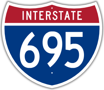
I-695
· Baltimore Beltway
Total: 51.46 mi.; full belt around Baltimore
Officially I-695: 32.09 mi.; from I-97 (Exit 4) near Ferndale clockwise to I-95 (Exit 33) near Rossville/Rosedale.
Officially MD 695: 19.37 mi.; from I-95 (Exit 33) near Rossville/Rosedale clockwise to I-97 (Exit 4) near Ferndale.
NHS: Entire length, including section that's officially MD 695. Marked all cardinal directions, inner and outer loop. The Baltimore Beltway was first conceived in October 1949 as the Baltimore County Beltway, in a study by the Baltimore County Planning Commission. The project began as a local county road project, until 1953 when it was taken over by the state. The first construction in Baltimore County began in the Towson area in 1955. The next year, it was incorporated into the Interstate system. It was in Anne Arundel County, however, that the first pieces of a proto-beltway began to appear in the early fifties, between the Baltimore-Washington Parkway and Nursery Rd., and later extending south to Baltimore-Annapolis Blvd. (then MD 3, now 648). An at-grade intersection existed at MD 170 (Exit 6) until the late sixties. The original length of the Beltway was completed in July 1962, running from Ritchie Hwy. (MD 2) in Glen Burnie clockwise 3/4 of the way around Baltimore to Pulaski Hwy. (US 40), from current exits 3 to 35. On the east side of Baltimore County, the Beltway was to be extended down the Back River Neck peninsula as the Southeast Freeway, then to cross Back River in approaching an outer crossing of the Patapsco River. Part of this extension was completed south to Eastern Blvd. (MD 150) in 1972, ending temporarily at Old Eastern Ave. (formerly MD 600). Construction of the rest of this alignment as a freeway was offically killed in July 1978. Parts of two other routes to the west along the Patapsco Neck were pressed into service, the Windlass and Patapsco Freeways. Only the section of the Windlass from the Beltway west to the proposed junction with the Patapsco Freeway was completed, then to head south along the Patapsco to a section near MD 150 which was begun as early as 1966. The proposed interchange between the two routes became a sharp bend. There is no exit 37 on 695, in case one route or the other was resurrected. The entire Windlass-Patapsco combination was completed by 1974, and made Beltway exits 36-42. The Southeast Freeway south of the Beltway split became MD 702, which was extended as an at-grade highway in 1990. Plans for an Other Harbor Crossing originally called for another tunnel similar to the Harbor Tunnel completed in 1958. In 1972 plans were revised, changing the facility from tunnel to bridge. The Key Bridge was completed in 1977, originally with two-lane approaches. The west approach, which also includes the Curtis Creek Drawbridge, was soon dualized, and the eastern approach was upgraded to 4-lane dual in November 1999, replacing a long 2-lane viaduct over the Sparrows Point industrial area. Although it's been signed I-695 since the late 1980s, the eastern part of the Beltway, from I-95 on the northeast side around to I-97 on the south, isn't officially an Interstate, but MD 695. Originally the Interstate portion of 695 ended at I-95 in the southwest side as well, but this would have been extended south to I-97 upon its completion. MD 695 (I) is a non-chargeable Interstate, which doesn't count against Maryland's chargeable Interstate mileage. It does get federal funding however, as part of the NHS. |
695
0.00 Drawbridge0.17 BC-AA Line 0.93 2 MD 10 7 1.84 3a MD 2 2.34 3b I-895sp 6b 2.78 4 I-97 17 3.54 5 MD 648 4.02 6 MD 170 4.84 7 MD 295 5.22 8 MD 168 5.70 AA-BA Line 5.91 8a I-895 3 6.14 9 (MD 891) 6.83 10 US 1 Alt 7.29 11 I-95 49 8.06 12a US 1 9.02 12bc MD 372 10.26 13 MD 144 10.74 14 Edmonson 11.49 15 US 40 12.90 16 I-70 91 13.36 17 MD 122 15.90 18 MD 26 17.70 19 I-795 1 18.67 20 MD 140 19.41 21 MD 129 19.90 21 Stevenson 21.31 22 Greenspr 23.04 23a I-83* 13 23.04 23b MD 25 24.56 24 I-83* 14 25.18 25 MD 139 26.20 26 MD 45 26.82 27 MD 146 28.08 28 Providence 28.82 29a Cromwell 28.99 29b MD 542 30.05 30 MD 41 31.19 31ab MD 147 31.70 31c MD 43 32.82 32 US 1 34.37 33 I-95 64 35.56 34 MD 7 35.90 35 US 40 36.25 36 MD 702 39.03 38 MD 150 39.39 39 Merritt 40.35 40 MD 151 41.38 41 Cove 43.86 42 MD 151 45.03 43 MD 157 45.03 43 MD 158 46.79 44 MD 695 48.66 BA-BC Line 48.66 Key Bridge-Toll (cars $2.00) 50.56 1 Quarantine |